Property Record
961 Memory Ln, Gallatin, TN 37066
NEARBY LISTINGS FOR SALE OR LEASE
Property Detail
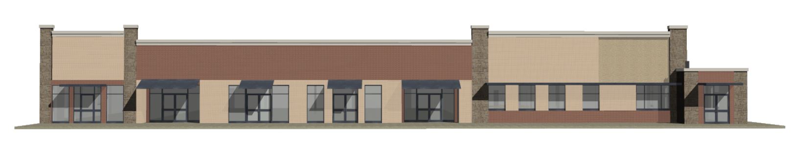
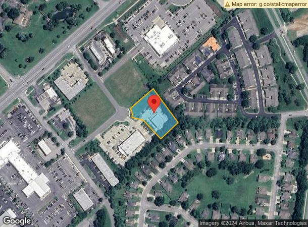
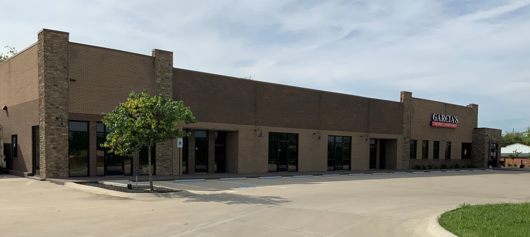
961 Memory Ln
Nashville-Davidson--Murfreesboro--Franklin, TN
Woods Commons Sec 1
136-014.01
PLAT: 27 PAGE: 97 BLOCK: LOT: 2 SUBD: WOODS COMMONS SEC 1
Autorepair
Sumner
X
Tennessee
47165C0426G
2
2023
1.05 AC
2023
Hendersonville-Gallatin
020501
Nashville
3,600 SF
DEMOGRAPHICS near 961 Memory Ln
1 Mile
3 Mile
5 Mile
2024 Total Population
5,458
36,229
70,047
2029 Population
6,167
40,867
78,787
Pop Growth 2024-2029
+ 12.99%
+ 12.80%
+ 12.48%
Average Age
44
41
40
2024 Total Households
2,359
14,521
26,967
HH Growth 2024-2029
+ 13.35%
+ 13.12%
+ 12.74%
Median Household Inc
$67,936
$68,127
$69,660
Avg Household Size
2.30
2.40
2.50
2024 Avg HH Vehicles
2.00
2.00
2.00
Median Home Value
$531,575
$360,805
$369,505
Median Year Built
2006
2004
2001
Nearby Places
- Restaurants
- Banks
- Shops
- Fitness
- Groceries
PUBLIC TRANSPORTATION
AIRPORT
Nashville International
DRIVE
WALK
Distance
Nashville International
42 min
33.3 mi
Freight Ports
Port of Mobile
DRIVE
WALK
Distance
Port of Mobile
514 min
470.8 mi
SALE & LEASE HISTORY
LISTING DATE
SALE/LEASE

Sep 27, 2019
For Lease
Sep 15, 2021
For Sale
Sep 13, 2023
For Lease
Oct 08, 2018
For Lease
May 21, 2019
For Lease
Jan 30, 2020
For Lease
Aug 22, 2017
For Lease
Aug 11, 2017
For Lease
Apr 12, 2023
For Lease
Apr 12, 2023
For Sale
Nearby Properties
Address
Land Use
TOTAL SIZE
Lot Size
Zoning
Address
Land Use
TOTAL SIZE
Lot Size
Zoning
47,729 SF
28.52 AC
Address
Land Use
TOTAL SIZE
Lot Size
Zoning
32,000 SF
17.33 AC
Address
Land Use
TOTAL SIZE
Lot Size
Zoning
1,055,495 SF
126.40 AC
Address
Land Use
TOTAL SIZE
Lot Size
Zoning
4,632 SF
22.74 AC
Address
Land Use
TOTAL SIZE
Lot Size
Zoning
10,208 SF
29.53 AC
ESTATEA
Address
Land Use
TOTAL SIZE
Lot Size
Zoning
18,734 SF
12.33 AC
MU
Address
Land Use
TOTAL SIZE
Lot Size
Zoning
29,160 SF
20.02 AC
Address
Land Use
TOTAL SIZE
Lot Size
Zoning
82,479 SF
28.56 AC
IR
Address
Land Use
TOTAL SIZE
Lot Size
Zoning
27,816 SF
10.76 AC
MU
Address
Land Use
TOTAL SIZE
Lot Size
Zoning
84,730 SF
5.99 AC
Address
Land Use
TOTAL SIZE
Lot Size
Zoning
15,189 SF
7.84 AC
Address
Land Use
TOTAL SIZE
Lot Size
Zoning
16,736 SF
14.10 AC
Address
Land Use
TOTAL SIZE
Lot Size
Zoning
99,333 SF
1.73 AC
ESTATEA
Address
Land Use
TOTAL SIZE
Lot Size
Zoning
52,475 SF
14.46 AC
Address
Land Use
TOTAL SIZE
Lot Size
Zoning
205,182 SF
21.90 AC
CG
Address
Land Use
TOTAL SIZE
Lot Size
Zoning
131,339 SF
18.22 AC
Address
Land Use
TOTAL SIZE
Lot Size
Zoning
5,992 SF
15.38 AC
Address
Land Use
TOTAL SIZE
Lot Size
Zoning
35,569 SF
6.99 AC
Address
Land Use
TOTAL SIZE
Lot Size
Zoning
72,542 SF
9.99 AC
MRO
Address
Land Use
TOTAL SIZE
Lot Size
Zoning
156,213 SF
14.80 AC
PGC
Address
Land Use
TOTAL SIZE
Lot Size
Zoning
62,245 SF
2.45 AC
Address
Land Use
TOTAL SIZE
Lot Size
Zoning
9,568 SF
16.50 AC
Address
Land Use
TOTAL SIZE
Lot Size
Zoning
38,274 SF
9.27 AC
CPUD
Address
Land Use
TOTAL SIZE
Lot Size
Zoning
18,016 SF
17.90 AC
Address
Land Use
TOTAL SIZE
Lot Size
Zoning
34,548 SF
5.11 AC
MU
Address
Land Use
TOTAL SIZE
Lot Size
Zoning
62,855 SF
3.46 AC
PGC
Address
Land Use
TOTAL SIZE
Lot Size
Zoning
37,146 SF
3.07 AC
Address
Land Use
TOTAL SIZE
Lot Size
Zoning
5,684 SF
4.79 AC
Address
Land Use
TOTAL SIZE
Lot Size
Zoning
23,114 SF
4.08 AC
Address
Land Use
TOTAL SIZE
Lot Size
Zoning
27,007 SF
5.82 AC
The World's #1 Commercial Real Estate Marketplace
Connect with us
© 2025 CoStar Group
The information above has been obtained from sources believed reliable. While we do not doubt its accuracy we have not verified it and make no guarantee, warranty or representation about it. It is your responsibility to independently confirm its accuracy and completeness. Any projections, opinions, assumptions, or estimates used are for example only and do not represent the current or future performance of the property. The value of this transaction to you depends on tax and other factors which should be evaluated by your tax, financial, and legal advisors. You and your advisors should conduct a careful, independent investigation of the property to determine to your satisfaction the suitability of the property for your needs.